Featuring resilience resources monthly
Each month a different resource or tool that can assess shoreline changes, provide education on resilient practices, or support planning and policy development for coastal communities is highlighted in this blog.
This blog is organized by year. For every year, the resources of the month are listed. The blog posts for each of the resources are available at the end of each year’s summaries.
2024
October: Shoreline Inventory and Oblique Photo Viewer – Featuring NEW Photos from 2024
September: Great Lakes Environmental Justice Thriving Communities Technical Assistance Center
August: Local Infrastructure Hub
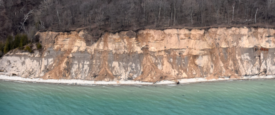
June: Visual Signs of Erosion Photo Guide
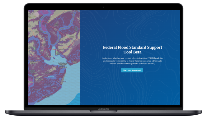
April: Federal Flood Standard Support Tool
March: New FEMA Special Flood Hazard Areas for Lake Michigan Coastal Communities
January: Coastal Hazard Regulations in Great Lakes States: A Summary Analysis
Local Infrastructure Hub
Helping navigate federal funding opportunities. Local Infrastructure Hub Launch...
Great Lakes Environmental Justice Thriving Communities Technical Assistance Center
Helping navigate federal funding opportunities. Great Lakes Environmental Justice...
Federal Flood Standard Support Tool
A new tool for determining flood risk. Federal Flood...
Visual Signs of Erosion Photo Guide
A guide for spotting signs of erosion along Wisconsin’s coastlines....
2023
September: Wisconsin Culvert Inventory Database and Online Mapping App
August: Wisconsin Climate Table
July: USACE Beneficial Use of Dredged Sediment
June: Ready-to-Fund Resilience Toolkit
May: Building Community Resilience with Nature-Based Solutions
April: Wisconsin Coastal Resilience Funding Inventory
March: Great Lakes Natural & Nature-Based Features Playbook
February: NOAA Digital Coast
January: Implementing the Steps to Resilience: A Practitioner’s Guide
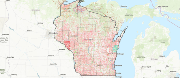
Wisconsin Culvert Inventory Database and Online Mapping App
An inventory of culvert infrastructure across Wisconsin. Wisconsin Culvert...
Wisconsin Climate Table
A tool kit for communities looking to center equity in...
USACE Beneficial Uses of Dredged Sediment Website
A website supporting the beneficial use of dredged sediment in...
Ready-to-Fund Resilience Toolkit
An online toolkit helping local governments develop ready-to-fund projects. ...
2022
December: Wisconsin Great Lakes Marina Resilience Assessment
November: Wisconsin Coastal Guide
October: Wisconsin Coastal Resilience Website
September: Shoreline Inventory and Oblique Photo Viewer – Featuring NEW Photos from 2022
August: Science Communications Toolkit
July: Equitable Community Resilience Adaptation Toolkit
June: ReduceFloodRisk.org
April: Great Lakes Coastal Resilience Planning Guide
March: WICCI’s 2021 Assessment Report: Wisconsin’s Changing Climate
February: NOAA Coastal County Snapshots
January: Wisconsin Shoreline Inventory and Oblique Viewer – Featuring NEW Photos from 2021
Wisconsin Great Lakes Marina Resilience Assessment
A guide that helps identify risks and vulnerabilities and provide options to increase...
Wisconsin Coastal Guide
Interactive story map that explores coastal access sites and natural and cultural attractions...
Wisconsin Coastal Resilience Website
The Wisconsin Coastal Resilience website is a hub for coastal resilience related information...
2021
October: Five guidance documents from the Southeastern Wisconsin Coastal Resilience Project:
- A Property Owner’s Guide to Protecting Your Bluff
- Nature-Based Shorelines for Wisconsin’s Great Lakes Coast
- Great Lakes Beach Resilience Guide
- Great Lakes Port, Harbor, and Marina Infrastructure and Dredging Cost Evaluations Matrix Tool
- Great Lakes Quests
August: FEMA Hazard Mitigation Assistance Grant Programs
July: Blue Accounting for the Great Lakes
June: Great Lakes Coastal Shore Protection Structures and Their Effects on Coastal Processes
May: The Certified Coastal Practitioner Program
April: Diving into the Digital Coast: Great Lakes
March: USACE Monthly Bulletin of Great Lakes Water Levels
February: Funding and Financing for Coastal Resiliency
January: Wisconsin Shoreline Inventory and Oblique Viewer – Updated with 2020 Images
Great Lakes Coastal Shore Protection Structures and Their Effects on Coastal Processes
This fact sheet explains Great Lakes coastal processes and how engineered structures can affect the...
US Army Corps of Engineers Monthly Bulletin of Great Lakes Water Levels
A set of online figures that depict past, present, and future water levels for each...
Updated: Wisconsin Shoreline Inventory & Oblique Photo Viewer – Featuring NEW photos from 2020
A web-based, interactive map of Wisconsin coastal data that enables users to visualize the temporal...
2020
December: Resilient Future for Coastal Communities Report
November: Working with Engineers and Contractors
October: Ohio Coastal Design Manual
September: National Weather Service Great Lakes Portal
August: Protect You Home from Bluff Erosion Fact Sheet
July: Great Lakes Water Level Dashboard
June: Green Infrastructure Code Audit Workbook
May: Model Ordinance for Lake Michigan Bluff Setbacks
April: USACE Great Lakes High Water Webpage
February: Wisconsin Coastal Atlas
January: New York Sea Grant Great Lakes Coastal Resilience Index
Working With Engineers and Contractors on Shore Protection Projects
This fact sheet describes the standard procedures of a coastal protection project. Working With...
Wisconsin Coastal Atlas
A technology platform that enables people to better understand coastal issues, share coastal data and...
Protect Your Home from Bluff Erosion: Fact Sheet
Fact sheet that lays out the most pertinent information about risk factors of bluff failure,...
2019
November: Great Lakes Coastal Shore Protection Structures & Their Effects on Coastal Processes
October: Great Lakes Water Level Dashboard
September: Stabilizing Coastal Slopes for the Great Lakes
August: Wisconsin Shoreline Inventory and Oblique Viewer – Featuring NEW Bluff Recession Data
July: Adapting to a Changing Coast (for Property Owners)
June: Lake Level Viewer
May: Naturally Resilient Communities
April: Vegetative Best Management Practices
March: Working with Engineers and Contractors
February: Living on the Coast: Protecting Investments in Shore Property
January: USACE Monthly Bulletin of Great Lakes Water Levels
Working With Engineers and Contractors on Shore Protection Projects
This fact sheet describes the standard procedures of a coastal protection project. Working With...
Vegetative Best Management Practices: A Manual for Pennsylvania/Lake Erie Bluff Landowners
A handbook that provides technical assistance to Lake Erie property owners affected by shoreline erosion...
Updated: Wisconsin Shoreline Inventory & Oblique Photo Viewer – Featuring NEW Bluff Recession Data
A web-based, interactive map of Wisconsin coastal data that enables users to visualize the temporal...
2018
December: Great Lakes Coastal Forecasting System
November: Wisconsin Shoreline Inventory and Oblique Viewer
October: Southeastern Wisconsin Coastal Community Overview
Wisconsin Shoreline Inventory & Oblique Photo Viewer
A web-based, interactive map of Wisconsin coastal data that enables users to visualize the temporal...
Great Lakes Coastal Forecasting System
Online models that predict Great Lakes surface water conditions. Great Lakes Coastal Forecasting System...
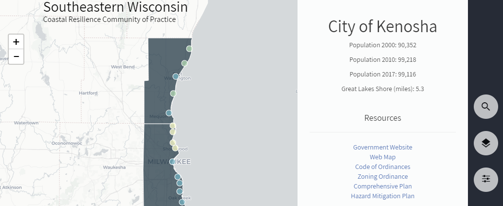
Southeastern Wisconsin Coastal Community Overview Map
Southeastern Wisconsin Coastal Community Overview Map \ An interactive map has been developed that provides...
