A web-based, interactive map of Wisconsin coastal data that enables users to visualize the temporal changes to Wisconsin’s shorelines.
Wisconsin Shoreline Inventory and Oblique Photo Viewer
Overview
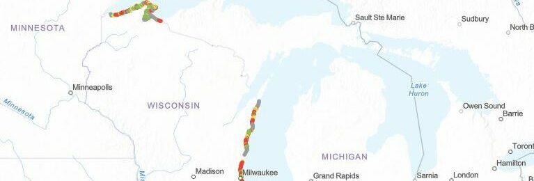
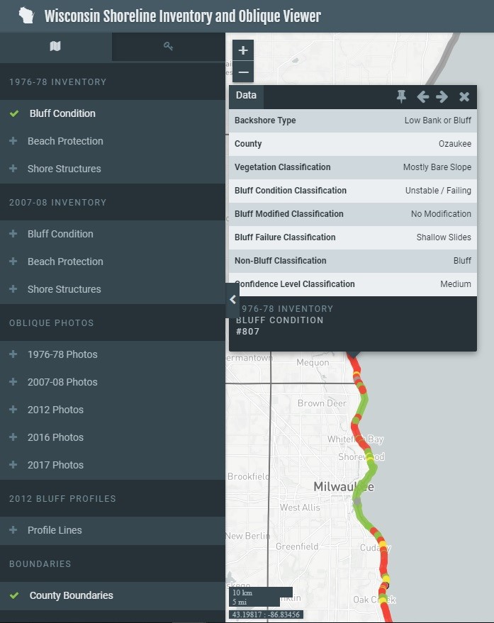
The Shoreline Inventory and Oblique Photo Viewer is a web-based, interactive map of Wisconsin coastal data that enables users to visualize the temporal changes to Wisconsin’s shorelines. This map is a qualitative inventory of shoreline conditions, researched by David Mickelson (University of Wisconsin – Madison) and developed in partnership with the Wisconsin Coastal Management Program, University of Wisconsin Sea Grant Institute, and the Association of Floodplain Managers.
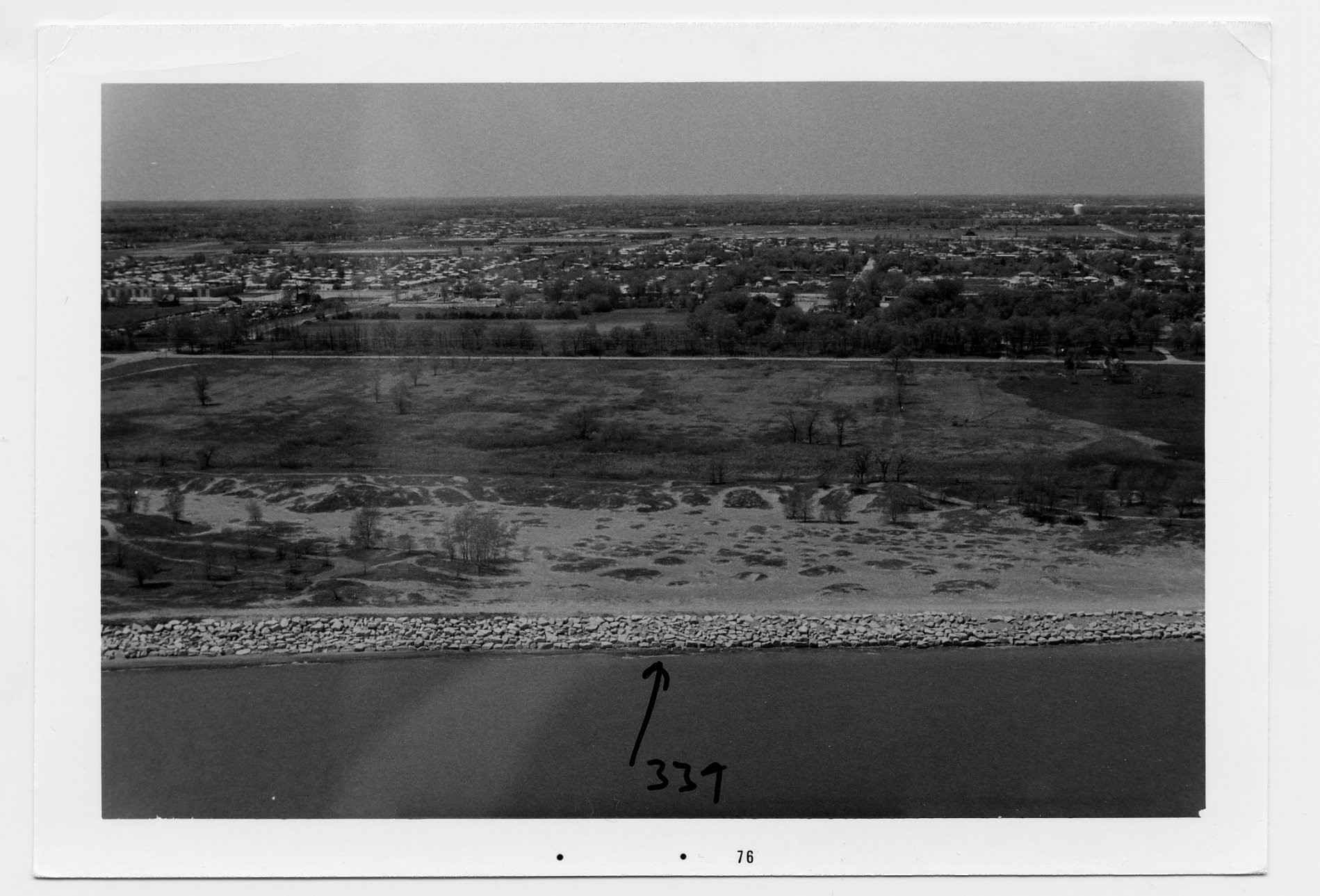
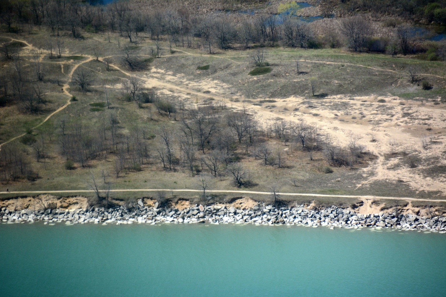
Bluff, beach, and shoreline protection structure resiliency is color-coded on the map to indicate stable, moderately stable, moderately unstable, or failing conditions. Users can click anywhere on the shoreline to learn more about its classification. Photographs of the coast from 1976 to 2017 were compiled from the Wisconsin DNR, US Army Corps of Engineers, and Wisconsin Civil Air Patrol and geolocated on the map of Wisconsin allowing users to view images from different years side-by-side to visualize coastal change. The photographs, data layers, and profile data are available to the public for downloading.
Audience
The Viewer is designed for anyone to use to learn more about past and present shoreline conditions on Lakes Michigan and Superior. Users are able to zoom-in on their community or zoom-out and look at Wisconsin’s shorelines as a whole. Data layers are located on the side of the map and can be displayed or hidden to show the information the user wants to visualize.
Decision Support
The Viewer was developed to understand the changes in Wisconsin’s coastlines over time. At its core, the Viewer provides an inventory of shoreline conditions and erosion management practices. Toggling through the data layers and comparing photographs allows users to identify and prioritize areas for coastal management such as bare or failing bluffs, or disappearing beaches.


Go to the Shoreline Inventory and Oblique Viewer and see for yourself!
