About
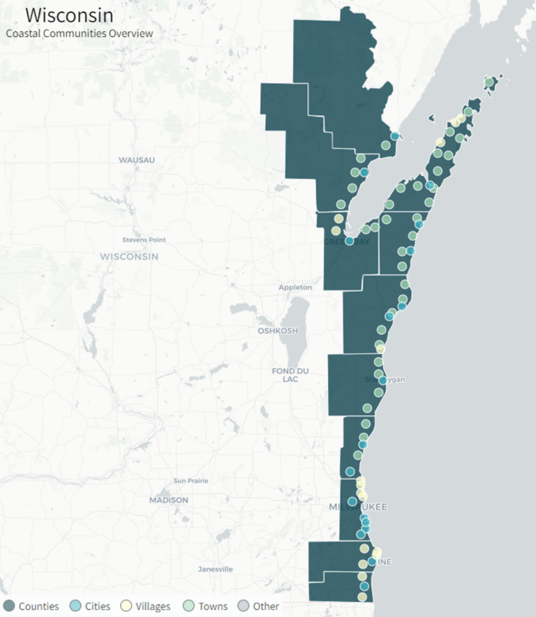
Many entities in Wisconsin are working together to build resilience to coastal hazards in our Lake Michigan coastal communities. Within Wisconsin’s 11 Lake Michigan coastal counties, there are 18 cities, 16 villages, and 36 towns. Starting with a small group in 2015, Wisconsin Sea Grant led an Integrated Assessment of changing Lake Michigan water levels and their impacts on coastal bluffs and beaches in Southeastern Wisconsin. The Integrated Assessment, as well as other multi-stakeholder assessments in the region, identified specific needs to enhance coastal resilience in three key areas: (1) prediction and mapping of shoreline erosion & bluff failure; (2) communication of risks & actions; and (3) guidance & facilitation on collaborative solutions. In 2018, the Southeastern Wisconsin Coastal Resilience Project was funded to leverage the momentum generated by the Integrated Assessment project towards collaborative regional actions. The project was successful in forming and engaging the Southeastern Wisconsin Coastal Resilience Community of Practice as well as providing mapping and risk communication resources. In 2021, the Collaborative Action for Lake Michigan Coastal Resilience project was funded to expand the risk communication framework of the Southeastern Wisconsin Coastal Resilience Project to the rest of Wisconsin’s Lake Michigan coastal communities. This Lake Michigan-wide project is connecting the resilience efforts in Southeastern Wisconsin to those in Wisconsin’s Green Bay and Northeastern coastal communities to regionally prioritize and address coastal hazards.
Collaborative Action for Lake Michigan (CALM) Coastal Resilience
Building on the risk communication framework of the Southeastern Wisconsin Coastal Resilience Project, the Wisconsin Coastal Management Program, University of Wisconsin Sea Grant Institute, Wisconsin State Cartographer’s Office, and the Wisconsin Department of Administration’s State Geographic Information Officer partnered to develop the Collaborative Action for Lake Michigan (CALM) Coastal Resilience network funded by a NOAA Projects of Special Merit grant.
CALM is a network for all of Wisconsin’s Lake Michigan coastal communities working to continue building resilience to coastal hazards by expanding collaboration across the region, supporting development of local policies and plans, coordinating the regional prioritization of hazard needs, and sustaining and strengthening existing coastal resilience networks. CALM will focus on assisting communities in developing, revising, or adopting local ordinances and/or coastal hazard plans and policies through outreach, data development and management, and promoting products and tools.
Project Components
By organizing Wisconsin’s Lake Michigan stakeholders including new and existing communities of practice, coastal management networks, agencies, organizations, and local governments, CALM can leverage lessons learned, case studies, and data infrastructure with a history of success to continue propelling coastal hazard efforts in Wisconsin forward.
- Facilitate regularly scheduled meetings including workshops, case study presentations, demonstrations of decision support tools and guidance documents, and discuss opportunities for collaborative actions.
- Inventory projects in Wisconsin that have led to a program change including revisions of locally adopted plans, maps, and ordinances; inclusion of coastal hazards in local comprehensive plan updates; inclusion of coastal hazards in local hazard mitigation plans; revisions to State of Wisconsin All Hazards Plan; and revisions to local ordinances to address barriers to flood protection
- Identify funding sources communities, organizations, and agencies can use to support these types of projects.
- Coordinate with WICDI to bring their collaborative mapping and database management approach to the Lake Michigan region through presentations, demonstrations, and field trips.
- Expand the scope of the Southeastern Wisconsin Coastal Resilience Project website to include Wisconsin’s entire Lake Michigan region.
- Continue developing and adding content to support learning and decision-making through access to technical resources and case studies.
- Direct stakeholders to available decision-support resources.
Project Partners
Steering Committee
The steering committee guides the development of CALM network meetings, shares resources, provides networking opportunities, provides expertise and perspective on the project approach and other key decisions as the project develops. The committee is composed of members from 15 different organizations, agencies, and coastal communities. See the list of members below.
- Association of State Floodplain Managers (ASFPM)
- Bay Lake Regional Planning Commission (BLRPC)
- City of Manitowoc
- Great Lakes and St. Lawrence Cities Initiative (Cities Initiative)
- Lakeshore Natural Resource Partnership (LNRP)
- Milwaukee Metropolitan Sewerage District (MMSD)
- NEW Water
- Ozaukee County
- Southeastern Wisconsin Regional Planning Commission
- University of Wisconsin-Madison Civil and Environmental Engineering (UWCEE)
- United States Army Corps of Engineers – Chicago District (USACE)
- University of Wisconsin-Parkside
- Wisconsin Department of Natural Resources (WDNR)
- Wisconsin Coastal Management Program (WCMP)
- Wisconsin Emergency Management (WEM)
Funding
Funded by the Wisconsin Coastal Management Program and the National Oceanic and
Atmospheric Administration, Office for Coastal Management under the Coastal Zone
Management Act, Grant # NA21NOS4190032.
Southeastern Wisconsin Coastal Resilience Project
The bluffs, beaches and harbor infrastructure of Wisconsin are vulnerable to coastal hazards including erosion, coastal storms, and fluctuating water levels. These coastal hazards can threaten coastal properties and impair economic security of the region’s tourism and commerce. Planning, preparing for, and adapting to coastal hazards can enhance community resilience and strengthen coastal economies.
The Wisconsin Coastal Management Program, University of Wisconsin Sea Grant Institute, University of Wisconsin-Madison Department of Civil and Environmental Engineering, and the Southeastern Wisconsin Regional Planning Commission were awarded a three-year NOAA Coastal Resilience Grant to enhance community capacity in southeastern Wisconsin to build resilience to these coastal hazards. This project, known as the Southeastern Wisconsin Coastal Resilience Project, provides resources and assistance to southeastern Wisconsin communities in Ozaukee, Milwaukee, Racine, and Kenosha Counties to plan and prepare for coastal hazards.
Project Components
To provide needed information on coastal hazards, the project team’s scientists and outreach specialists evaluated and mapped shoreline recession rates in the region and developed educational resources on options to protect coastal assets.
Using these resources, the project team worked with counties and municipalities to assess their vulnerabilities to coastal hazards, prioritize potential actions to address coastal hazards and begin to implement some of these actions through small grants provided by the project funding. This effort organized as a coastal resilience community of practice for local officials, scientists, and outreach specialists to learn about, share experiences with, and develop approaches to plan and prepare for coastal hazards.
- Compile and Analyze Historic Shoreline Recession Data
Bluff recession and beach evolution was measured from historic aerial photographs from 1956 to 2015. These measurements are available on the Wisconsin Shoreline Inventory and Oblique Viewer. A detailed shoreline recession analysis was performed to characterize the shoreline response to both historic environmental conditions, including lake level changes and extreme storm waves, and historic anthropogenic changes such as the construction of shore protection structures. - Assess Shoreline Recession Scenarios
Empirical index model relationships were applied to estimate the effects of potential scenarios of storm waves, water levels, and shore protection structures on erosion and accretion along the coast. The effect of possible extreme storm waves and water levels conditions on shoreline recession was estimated using the cumulative wave impact height method. Shoreline armoring scenarios were also developed to quantify the range of impacts that various types of shore protection may have on the shoreline. These scenarios provided a range of shoreline recession rates that might be expected in the future. - Develop a GIS Shoreline Recession Database
A GIS-based visualization tool was created to share shoreline recession data and scenarios. This tool overlays historic recession data and potential scenarios on their applicable shoreline reaches in the region to illustrate the possible range of shoreline changes that could be expected to occur at a site, not just the historic conditions. These maps and tools provide easily accessible and readily usable information to aid decisions by both public and private stakeholders.
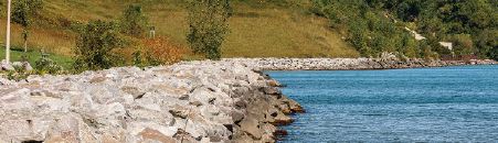
- A Property Owner’s Guide to Protecting Your Bluff
This guide explains practices that property owners can use to take care of their bluffs, including informed site usage, proper water drainage, stabilizing vegetation, and if necessary, bluff toe protection. The guide is structured with a “top-down” approach, starting with the bluff top where homes and infrastructure are often located, down to the water line where bluffs interact with the lake. (Go to Blog Post)
- Nature-Based Shorelines for Wisconsin’s Great Lakes Coast
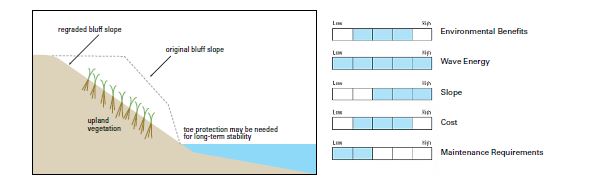
Nature-based shorelines (NBS) use or mimic natural features to stabilize the coast. These natural features can include vegetation, beaches, dunes, and reefs. In addition to protecting the coast against erosion and flooding, nature-based shorelines can also benefit ecosystems, aesthetics, and coastal processes. This guide describes six different types of NBS techniques that may be suitable for the Great Lakes and includes case studies for each technique to illustrate its use in this region. (Go to Blog Post)
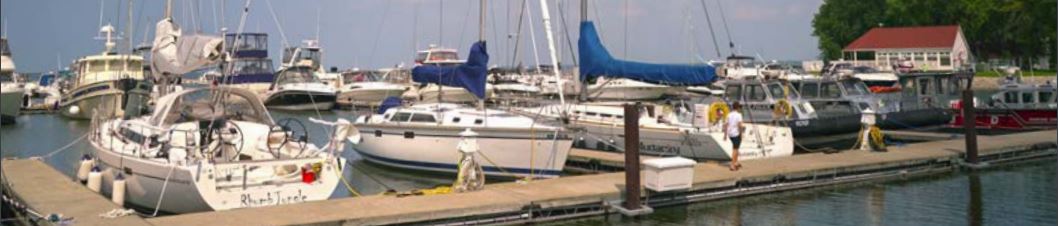
- Great Lakes Port, Harbor, and Infrastructure Cost Matrix and Dredging Contract Database
This tool provides a framework for non-technical users to estimate the cost to repair and replace Great Lakes port, harbor, and marina infrastructure as well as to dredge harbors committed to commercial and recreational navigation. Prices of labor and materials are dynamic and change frequently; however, the cost estimates calculated with this tool can help people understand the value of the existing infrastructure and anticipate potential future costs that may be required to maintain a functioning facility. This proactive planning can enhance the resilience of a port, harbor, or marina to adapt to, withstand and bounce back from the impacts of Great Lakes coastal hazards. The tool is comprised of two main components, an infrastructure repair and replacement cost matrix and a dredging cost database, as well as a case study example to illustrate its use. (Go to Blog Post)
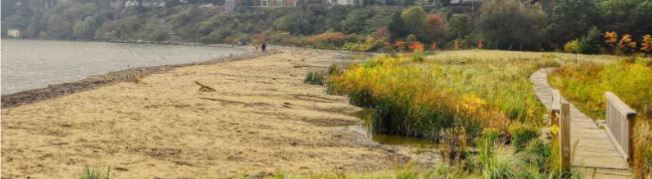
- Resilient Beach Practices Guide
Beaches are a valuable resource to coastal communities. Beaches play an integral role in the health of coastal communities by providing ecosystem services and habitat, public access to community resources and recreation, and contributing to the local economy. To residents and tourists alike, beaches are destinations and create a sense of place. For all these reasons and many more, this guide aims to be a useful tool to plan for, absorb, recover from, and adapt to coastal hazards and stressors. This guide provides a blueprint to communities and stakeholders on how to plan, build and maintain beaches that are resilient to coastal hazards. (Go to Blog Post)
- Great Lakes Quests
Great Lakes Quests are virtual learning activities about coastal issues and places in Wisconsin. An interactive ArcGIS StoryMap interspersed with text, images, and videos, and links to deeper web content provide a narrative about coastal resilience issues affecting the Lake Michigan coast of southeastern Wisconsin. The “quest” is to answer questions that reveal clues towards solving a word or phrase that is significant to the coastal issues and place. Wisconsin Sea Grant and the Upham Woods Outdoor Learning Center collaborated to develop these inquiry- and place-based learning activities. (Go to Blog Post)
- Wisconsin Great Lakes Marina Resilience Assessment
Coastal port, harbor and marina infrastructure and natural resources in Wisconsin are vulnerable to numerous hazards including intense storms, erosion, wave energy, flooding and inundation, ice, severe precipitation and fluctuating Great Lakes water levels. These hazards can impact working waterfronts, including marinas, threatening the structural integrity of infrastructure, damaging coastal natural resources, compromising the safety of marina staff and boaters, and impacting the economic well-being of coastal communities. The Wisconsin Great Lakes Marina Resilience Assessment is a resource for coastal marinas to help identify risks, vulnerabilities and information gaps, and provide a blueprint to coastal communities and marinas on how to identify, prioritize, plan and initiate enhancements to ensure marina resiliency to coastal hazards. This resource is incorporated into the Wisconsin Clean Marina Program and Guidebook. (Go to Blog Post)
Proposals were sought in the fall of 2018 for projects to plan and prepare for enhanced community resilience to coastal hazards in Southeastern Wisconsin. Applicants identified coastal resilience needs in a community Coastal Resilience Self-Assessment were encouraged to develop projects that would address these needs. Ten projects were selected to receive funding and are underway. As projects are completed, case studies are being written to summarize major project outcomes and lessons learned which can be found here.
Find summaries of the projects funded through the Southeastern Wisconsin Coastal Resilience Grant here: Coastal Resilience Grant Recipients
Project Partners
The Southeastern Wisconsin Coastal Resilience project is an opportunity to combine the strengths of multiple organizations in Wisconsin to bring research, outreach, and coordination expertise together to support communities as they plan and prepare for coastal hazards. These are the four primary organizations partnering on this project:
Collaborative Network
This project fosters a collaborative network of partners that address coastal hazards in southeastern Wisconsin, including local counties and municipalities, state agencies, federal agencies, and state workgroups and associations. All these counties and municipalities were invited to participate in the community of practice, conduct resilience self-assessment and guided assessment exercises, and develop and implement local resilience projects. For more information on how these communities are working on building coastal resilience, see the case studies page.
- Ozaukee County: Belgium, Port Washington (town), Port Washington (city), Grafton, Mequon
- Milwaukee County: Bayside, Fox Point, Whitefish Bay, Shorewood, Milwaukee, St. Francis, Cudahy, South Milwaukee, Oak Creek
- Racine County: Caledonia, Wind Point, North Bay, Racine, Mount Pleasant
- Kenosha County: Somers, Kenosha, Pleasant Prairie
- Wisconsin Emergency Management (WEM)
- Wisconsin Department of Natural Resources (WDNR)
- National Oceanic and Atmospheric Administration – Office of Coastal Management (NOAA OCM)
- United States Army Corps of Engineers (USACE)
- Wisconsin Coastal Beaches Workgroup
- Wisconsin Marine Association
- Wisconsin Harbor Towns Association
- Wisconsin Commercial Ports Association
- Wisconsin Coastal Hazards Workgroup
- Great Lakes Dredging Team
- Great Lakes Beach Association
Funding
Funding for this project is provided by the National Atmospheric and Oceanic Administration (NOAA) Coastal Resilience Grants program.
