Blog

Great Lakes Coastal Shore Protection Structures and Their Effects on Coastal Processes

This fact sheet explains Great Lakes coastal processes and how engineered structures can affect the shoreline.   Great Lakes Coastal Shore Protection Structures and Their Effects on Coastal Processes   Overview The publication Great Lakes…
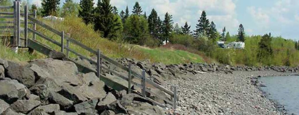
Erosion at County Park, bluffs along Lake Michigan. Credits: Ozaukee County

Working With Engineers and Contractors on Shore Protection Projects

This fact sheet describes the standard procedures of a coastal protection project.   Working With Engineers and Contractors on Shore Protection Projects   Overview Working with Engineers and Contractors on Shore Protection Projects is a…

Wisconsin Coastal Atlas

A technology platform that enables people to better understand coastal issues, share coastal data and inform decision-making about sustainable use of the Great Lakes.   Wisconsin Coastal Atlas   Overview The Wisconsin Coastal Atlas is a technology…

Vegetative Best Management Practices: A Manual for Pennsylvania/Lake Erie Bluff Landowners

A handbook that provides technical assistance to Lake Erie property owners affected by shoreline erosion and bluff recession.   Vegetative Best Management Practices: A Manual for Pennsylvania/Lake Erie Bluff Landowners   Overview Vegetative Best Management…

Updated: Wisconsin Shoreline Inventory & Oblique Photo Viewer – Featuring NEW Bluff Recession Data

A web-based, interactive map of Wisconsin coastal data that enables users to visualize the temporal changes to Wisconsin’s shorelines.   Wisconsin Shoreline Inventory & Oblique Photo Viewer Featuring NEW Bluff Recession Data   The Wisconsin…

Wisconsin Shoreline Inventory & Oblique Photo Viewer

A web-based, interactive map of Wisconsin coastal data that enables users to visualize the temporal changes to Wisconsin’s shorelines.   Wisconsin Shoreline Inventory and Oblique Photo Viewer   Overview The Shoreline Inventory and Oblique Photo…

US Army Corps of Engineers Monthly Bulletin of Great Lakes Water Levels

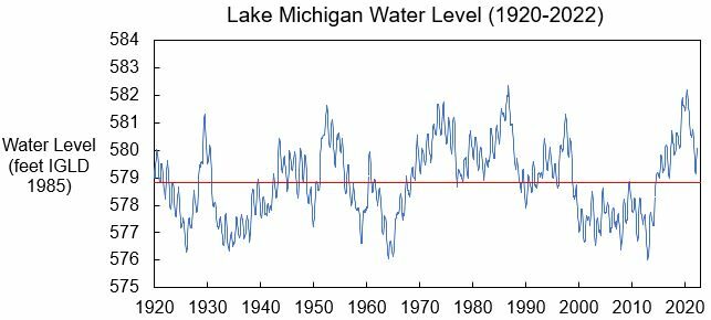
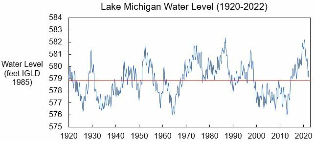
A set of online figures that depict past, present, and future water levels for each Great Lake.   US Army Corps of Engineers Monthly Bulletin of Great Lakes Water Levels   Overview The Monthly Bulletin of…

US Army Corps of Engineers Monthly Bulletin of Great Lakes Water Levels

A set of online figures that depict past, present, and future water levels for each Great Lake.   US Army Corps of Engineers Monthly Bulletin of Great Lakes Water Levels   Overview The Monthly Bulletin of…

Updated: Wisconsin Shoreline Inventory & Oblique Photo Viewer – Featuring NEW photos from 2020

A web-based, interactive map of Wisconsin coastal data that enables users to visualize the temporal changes to Wisconsin’s shorelines.   Updated: Wisconsin Shoreline Inventory & Oblique Photo Viewer Featuring NEW photos from 2020   The Wisconsin…

The Certified Coastal Practitioner™ Program

Credentialing program designed to provide participants with a wide scope of resources and instruction on a variety of elements related to coastal practice.   The Certified Coastal Practitioner™ (CCP) Program   Overview This program is…