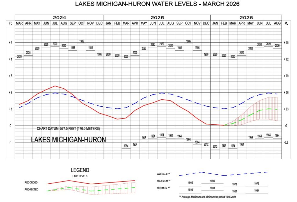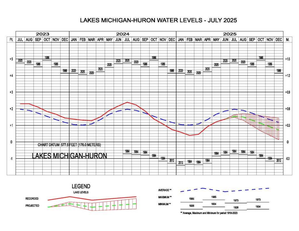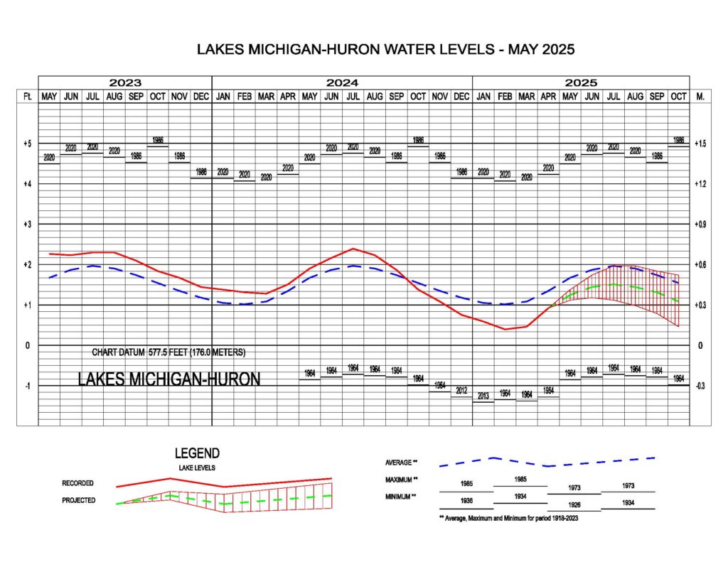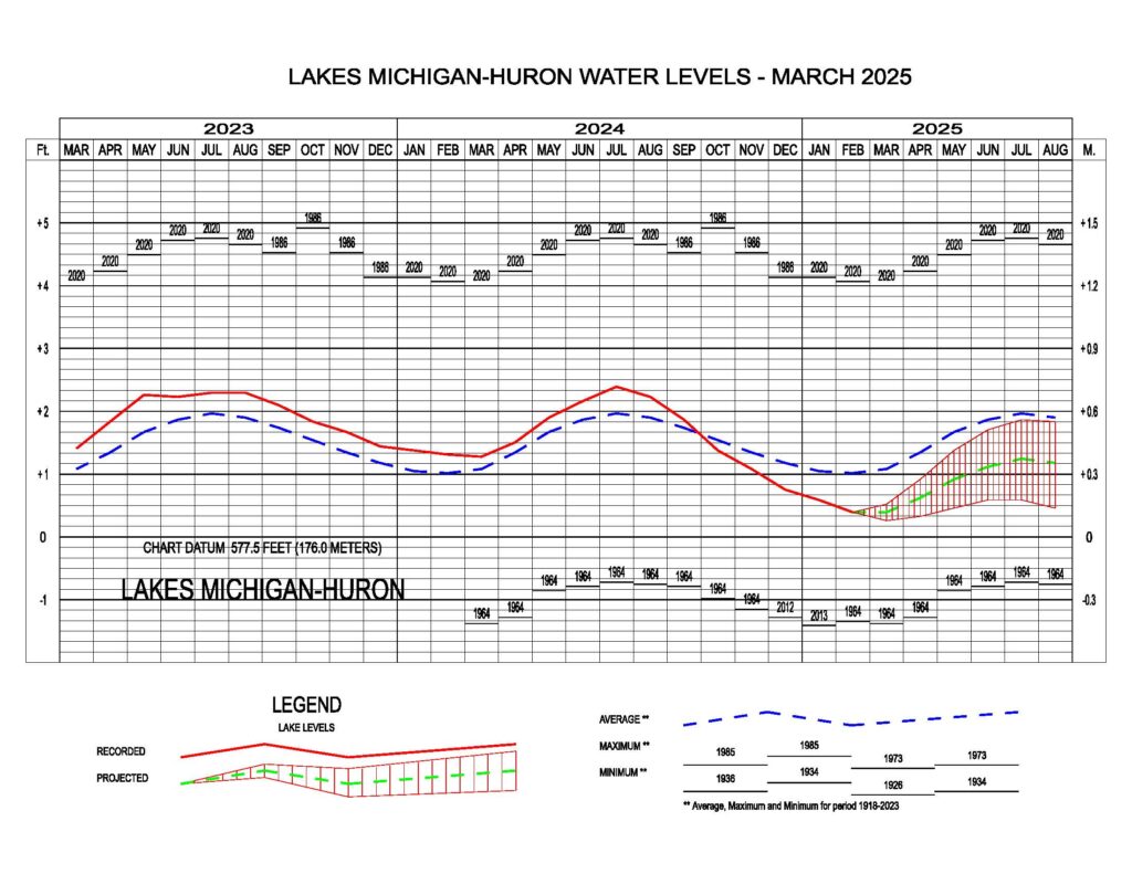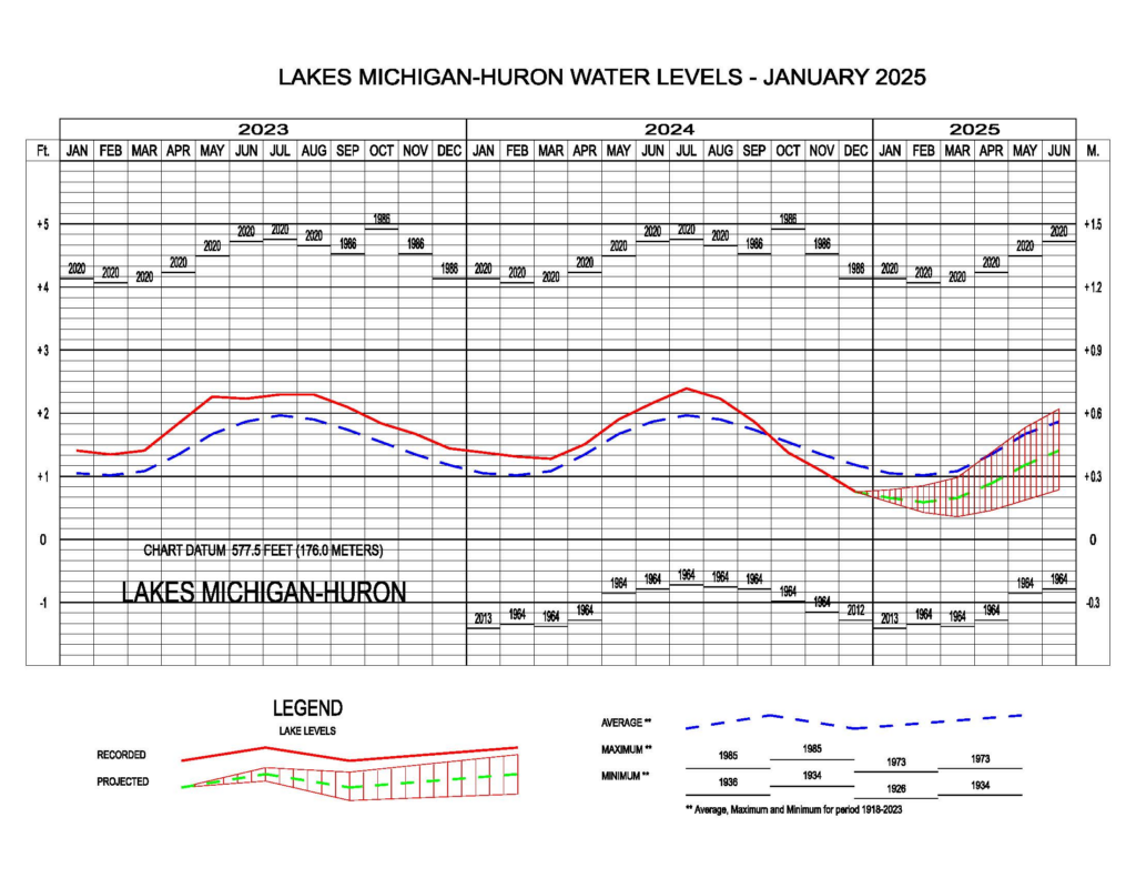
May 2026 Water Level Update
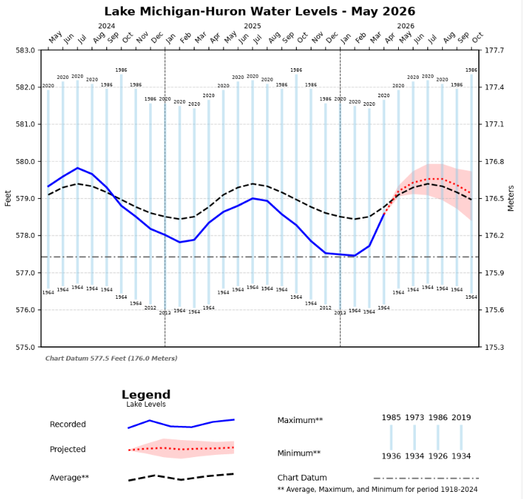
Following Wisconsin's wettest April on record, Lake Michigan water levels continued their seasonal rise, increasing 4 inches from April to May. Lake Michigan is now 2 inches above the long-term average water level for May.…