Great Lakes Natural & Nature-Based Features Playbook
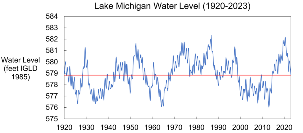
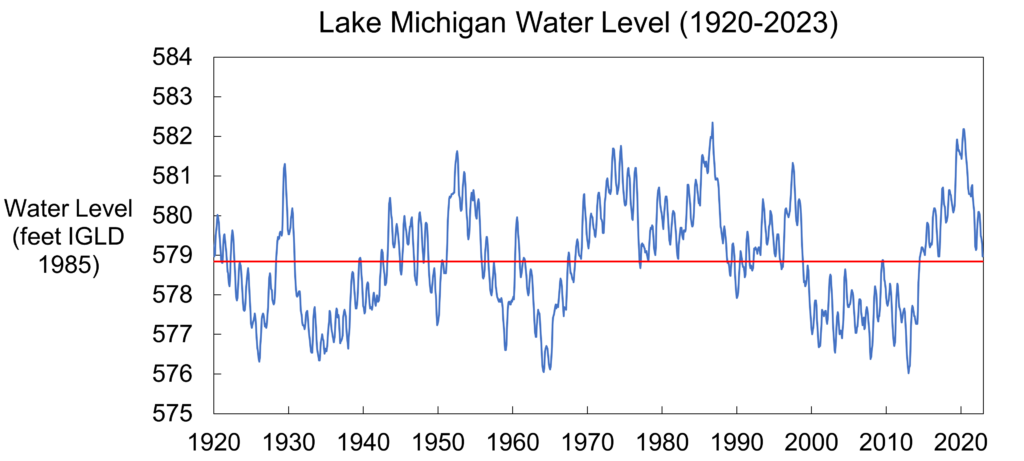
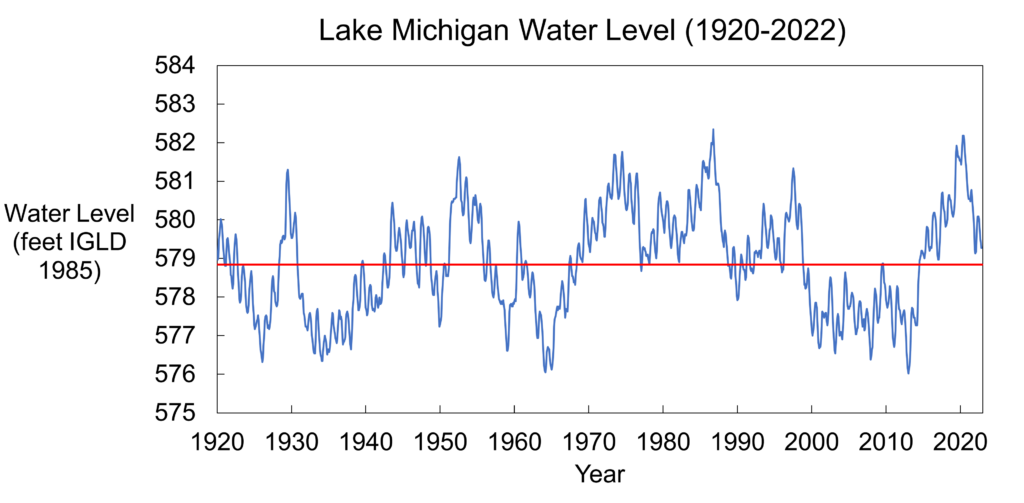
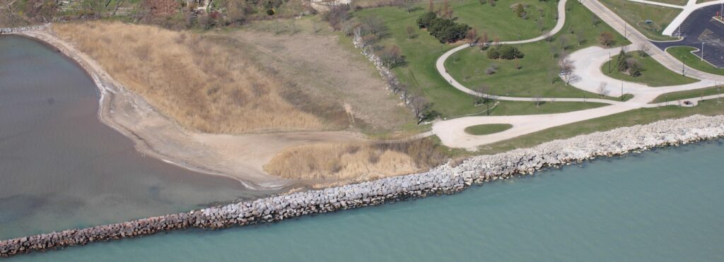
A guide to advance understanding of natural and nature-based features in the Great Lakes. Great Lakes Natural & Nature-Based Features Playbook Project Fact Sheet Overview Recent high lake levels have exposed the…