Virmond Park Walking Tour

Virmond Park Walking Tour

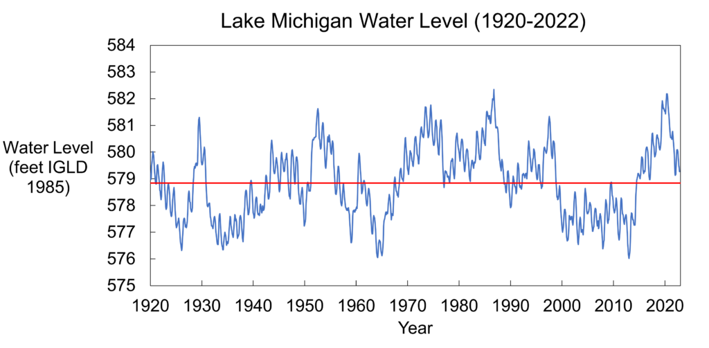
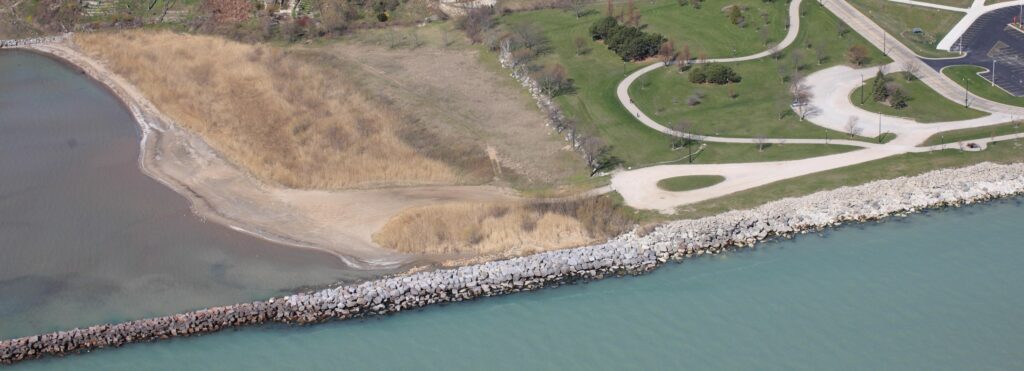
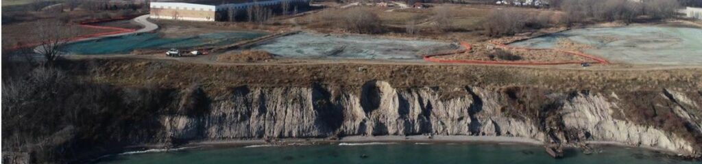
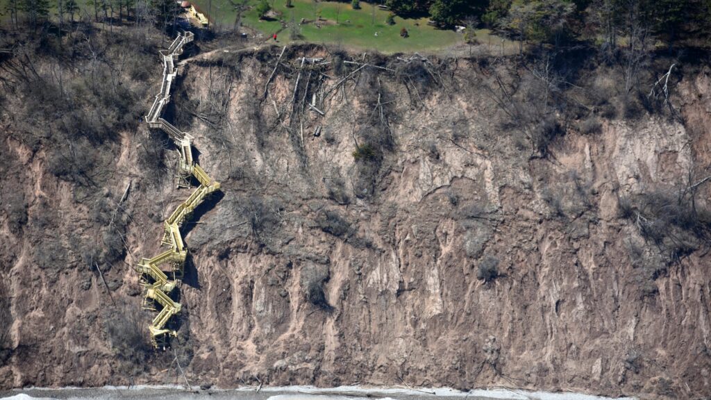
Walking tour of Virmond Park’s coastal access and water management projects in Mequon, WI.   Virmond Park Walking Tour Mequon, Wisconsin   The Collaborative Action for Lake Michigan (CALM) Coastal Resilience network hosted a field trip to Samuel Myers Park in Racine, Wisconsin on October 18, 2022. Andrew Struck from the Ozaukee County Planning and…
Read more

December 2022 Water Level Update

Lake Michigan water levels continued their seasonal decline, decreasing 5 inches from November to December. Though Lake Michigan is now about 31 inches below the highest monthly water level recorded for December 1986, the Lake is still about 4 inches above the long-term average water level for the month. Water levels are expected to continue…
Read more

Samuel Myers Park Walking Tour

Walking tour of the Samuel Myers Park coastal beach and wetland restoration project in Racine, WI.   Samuel Myers Park Walking Tour Racine, Wisconsin   The Collaborative Action for Lake Michigan (CALM) Coastal Resilience network hosted a field trip to Samuel Myers Park in Racine, Wisconsin on September 22, 2022. AJ Koski from the City…
Read more

Oak Creek Shoreline Resilience, Habitat, & Access Project

There was a need for a shoreline stabilization project to protect and Oak Creek bluff from erosion, create habitat, and provide safe public access to the shoreline.   Oak Creek Shoreline Resilience, Habitat, & Access   Overview The City of Oak Creek (the City) wanted to slow erosion at coastal bluff on the Peter-Cooper brownfield…
Read more

Introducing: Lake Superior National Estuarine Research Reserve

The Lake Superior National Estuarine Research Reserve protects and studies the Green Bay estuary.   Lake Superior National Estuarine Research Reserve     Who Are They? The Lake Superior National Estuarine Research Reserve works to improve the understanding of Lake Superior’s coast and estuaries by addressing issues through the integration of research, education, outreach, and…
Read more

Introducing: Green Bay National Estuarine Research Reserve

The Green Bay National Estuarine Research Reserve protects and studies the Green Bay estuary.   Green Bay National Estuarine Research Reserve     Who Are They? The future Green Bay National Estuarine Research Reserve will be a part of the National Estuarine Research Reserve System (NERR) of 30 sites across the coastal US designed to…
Read more

Wisconsin Great Lakes Marina Resilience Assessment

A guide that helps identify risks and vulnerabilities and provide options to increase marina resiliency.   Wisconsin Great Lakes Marina Resilience Assessment   Overview The Wisconsin Great Lakes Marina Resilience Assessment is a resource for coastal marinas to help identify risks, vulnerabilities and information gaps, and provide a blueprint to coastal communities and marinas on…
Read more

Wisconsin Coastal Guide

Interactive story map that explores coastal access sites and natural and cultural attractions found in Wisconsin’s Great Lakes communities.   Wisconsin Coastal Guide   Visit the Wisconsin Coastal Guide here   Overview The Wisconsin Coastal Guide is a collection of themed, interactive story maps highlighting the natural and cultural assets found in Wisconsin’s Great Lakes…
Read more

November 2022 Water Level Update

Lake Michigan water levels continued their seasonal decline, decreasing 2 inches from October to November. Though Lake Michigan is now about 31 inches below the highest monthly water level recorded for November 1986, the Lake is still about 7 inches above the long-term average water level for the month. Water levels are expected to continue…
Read more

Introducing: Wisconsin State Cartographer’s Office

Wisconsin State Cartographer’s Office provides maps, cartography, geographic and land information, and geospatial technology.   Wisconsin State Cartographer’s Office     Who Are They? The State Cartographer’s Office (SCO) is a part of the Department of Geography at the University of Wisconsin-Madison. It provides maps, cartography, geographic information systems (GIS), land information system (GIS), land…
Read more