A guide for spotting signs of erosion along Wisconsin’s coastlines.
Visual Signs of Erosion Photo Guide
Overview
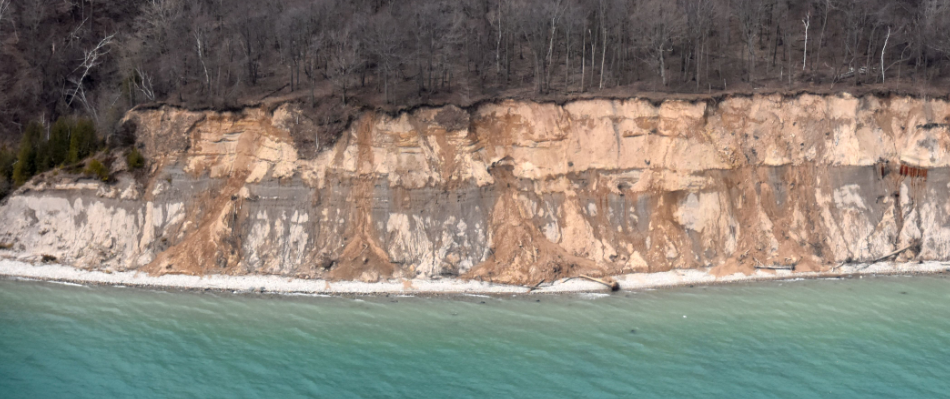
This photo guide was developed by Wisconsin Sea Grant and the Wisconsin Coastal Management Program for local government staff, planning and zoning staff, and coastal professionals to discuss erosion topics with property owners. This tool can help coastal managers and property owners spot signs of erosion such as tilted trees and ground cracks. The guide uses photos to show the different visual signs of erosion on beaches, bluffs, and around coastal infrastructure. This guide can be used to spark conversations with property owners about erosion and documenting change. The visuals this tool provides can be used to identify what is going on at a site or property. Capturing photos of these conditions annually is important for documenting changes to the coast – especially following storm events and changes in water levels.
What you’ll find in the guide
The photo guide provides reference photos for erosion occurring in different coastal environments, such as beaches, sand and clay bluffs, and rocky bluffs, as well as around shoreline protection infrastructure.
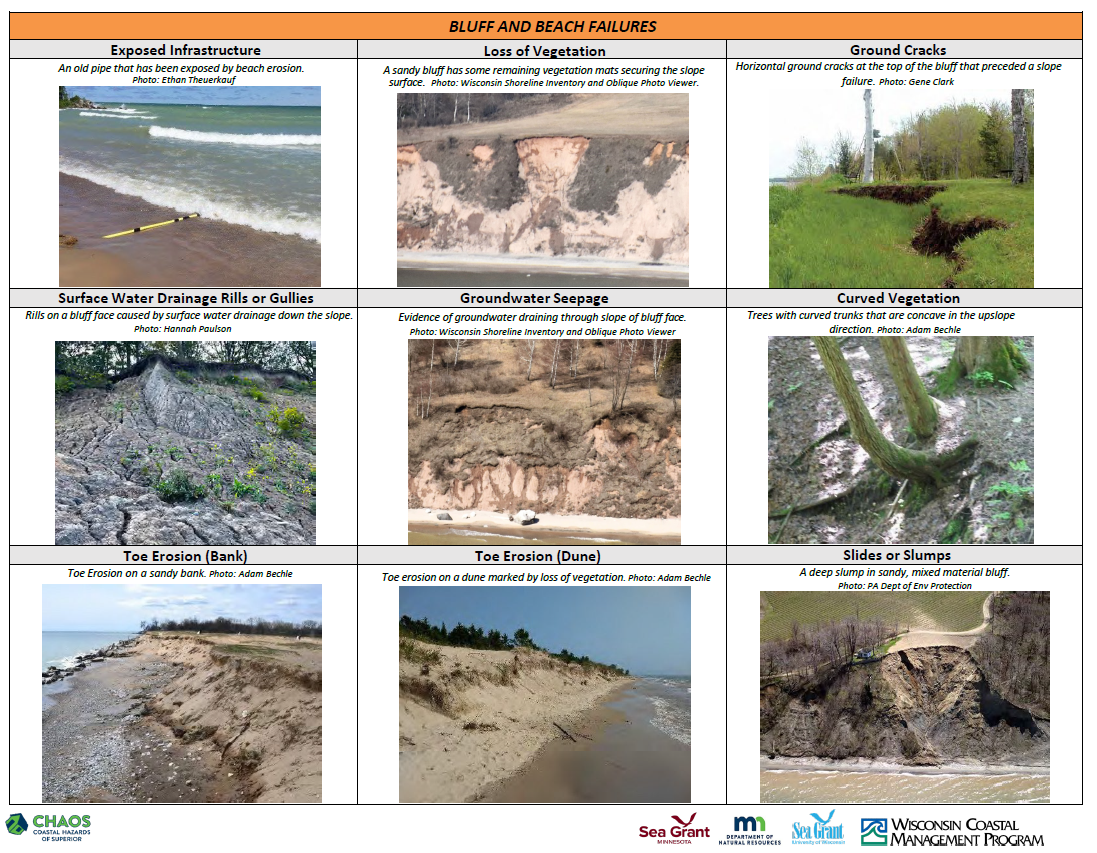
Visual signs of erosion for bluffs and beaches.
