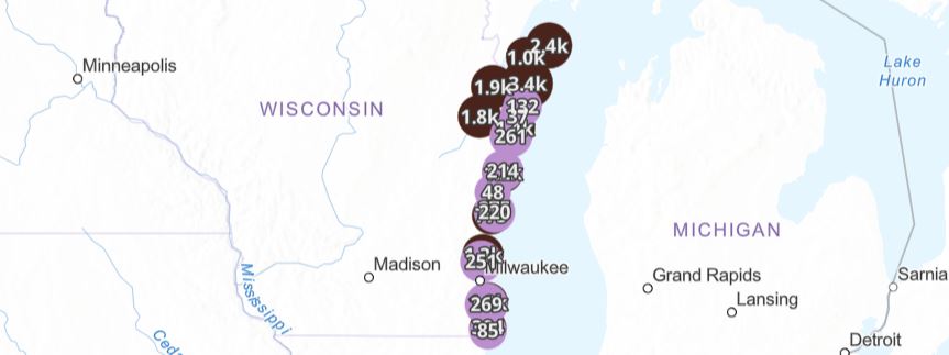
NOAA Coastal County Snapshots
Data hub that organizes county-level coastal resilience data for more than 850 coastal counties. NOAA Coastal County Snapshots Overview This data hub provided by the National Oceanic and Atmospheric Administration (NOAA) organizes county-level coastal resilience data for more than 850 coastal counties in the United States. Data are gathered from sources including the U.S.…
Read more